
DLG Viewer
Version 2.0 · Alfred Lee
Description
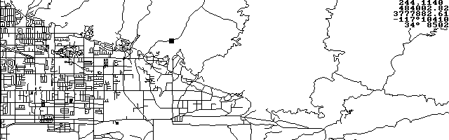
DLG Viewer is a United States Geological Service (USGS) Digital Line Graph (DLG) viewing and GPS moving map display utility. DLG is a DOS program ideally suited to run on the HP 100/200LX. The latest version handles rectangular and sinusoidal PCX maps and can invert them. Copyrighted freeware.
Technical details
- File
dlg200.zip- Size
- 162.0 KB
- Format
- .zip
- Year
- 1998
- Added to S.U.P.E.R.
- 1998-08-22
- Files inside
- 9
- Author
- Alfred Lee
- Path
anonftp/pub/dlg200.zip
How to install it
What to send to the palmtop saves 287.0 KB
These are the files you need. You can send them from the package contents below.
-
DLG.EXE→ A:\SOFT programa de DOS 46.6 KB
No need to put
SALNVY08.DLG, BIGBEAR.DLB, DEATHVLY.TRK, EXCLUDE.EXL, DLG.DOC, LINESTYL.STY, USCON.PCX, USCON.MAP:
they are manuals, source code or supporting material. Read them here and save 287.0 KB on a 1 MB disk.
Steps
- Copy DLG.EXE to A:\SOFT. They are DOS programs: run them from the DOS icon, or add A:\SOFT to the PATH in C:\AUTOEXEC.BAT to call them by name.
Derived from the package contents and the 200LX conventions. It installs to A: on purpose: C: is a RAM disk and every byte there is memory taken from the system.
The author's instructions
Quick start:

Demo 1: loading DLG and saving in propriotary binary format

    1.  dlg -h640 newbry02.dlg<Enter>           // at C:\DLG\>
    2.  <Esc>                                   // at prompt
    3.  s                             // after map is displayed
    4.  newbry02.dlb                  // save in .dlb format
    5.  <arrow keys>, <Pg Up/Down>, <Home>, <End>   // move
    6.  ctrl^<Pg Up/Down>, ctrl^<Home>, ctrl^<End>  // scroll

Demo 2:

    1.  dlg newbry02.dlb
    2.  x                                 // generate position
    3.  t                                 // trace track


PCX maps in rectangular projection:

DLG Viewer reads rectangular projection (all longitudes are
horizontal and all latitudes are vertical) maps store in PCX
format.  An auxiliary file with the same filename and the
extension '.map' is required to supply the co-ordinate
information.  The auxiliary file has the following format:

0 0 0 0
0 0 50.47482 124.432
1599 949 23.28759 64.6826

Line #1:
(four zeros separated by spaces for compatibility reason)

Line #2:
(image co-ordinate and actual longitude and latitude of a
point on the map)
X1              x pixel co-ordinate (left is 0)
Y1              y pixel co-ordinate (top is 0)
Lat1            latitude (north is positive)
Lon1            longitude (west is positive)

Line #3:
(image co-ordinate and actual longitude and latidute of
another point on the map)
X2              x pixel co-ordinate (left is 0)
Y2              y pixel co-ordinate (top is 0)
Lat2            latitude (north is positive)
Lon2            longitude (west is positive)

Notes: all numbers are separated by one or more spaces.


Generating PCX maps in sinusoidal projection:

The following server allows the generated image size to be
specified:

…
Literal excerpt from DLG.DOC, exactly as it came in the package.
Package contents
Send to my palmtop
The palmtop must be waiting before you press the button, or the transfer will fail. It is the palmtop that announces it is ready, not the other way round.
Your browser cannot talk to the serial port. Direct sending uses the Web Serial API, which only exists in Chrome, Edge and Opera on desktop — not in Firefox, Safari or any mobile browser.
Download the file with the button above and copy it to the palmtop your usual way.