
DLG Viewer
Versión 2.0 · Alfred Lee
Descripción
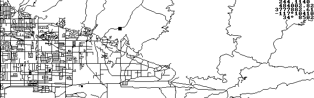
DLG Viewer is a United States Geological Service (USGS) Digital Line Graph (DLG) viewing and GPS moving map display utility. DLG is a DOS program ideally suited to run on the HP 100/200LX. The latest version handles rectangular and sinusoidal PCX maps and can invert them. Copyrighted freeware.
Ficha técnica
- Fichero
dlg200.zip- Tamaño
- 162.0 KB
- Formato
- .zip
- Año
- 1998
- Alta en S.U.P.E.R.
- 1998-08-22
- Ficheros dentro
- 9
- Autor
- Alfred Lee
- Ruta
anonftp/pub/dlg200.zip
Cómo instalarlo
Qué enviar al palmtop ahorras 287.0 KB
Estos son los ficheros que necesitas. Puedes enviarlos desde el contenido del paquete.
-
DLG.EXE→ A:\SOFT programa de DOS 46.6 KB
No hace falta llevar al palmtop
SALNVY08.DLG, BIGBEAR.DLB, DEATHVLY.TRK, EXCLUDE.EXL, DLG.DOC, LINESTYL.STY, USCON.PCX, USCON.MAP:
son manuales, código fuente o material de apoyo. Léelos aquí y ahórrate 287.0 KB en un disco de 1 MB.
Pasos
- Copia DLG.EXE a A:\SOFT. Son programas de DOS: se ejecutan desde el icono DOS, o añadiendo A:\SOFT al PATH de C:\AUTOEXEC.BAT para poder llamarlos por su nombre.
Deducido del contenido del paquete y de las convenciones del 200LX. Se instala en A: a propósito: C: es un disco RAM y cada byte ahí resta memoria al sistema.
Instrucciones del autor
Quick start:

Demo 1: loading DLG and saving in propriotary binary format

    1.  dlg -h640 newbry02.dlg<Enter>           // at C:\DLG\>
    2.  <Esc>                                   // at prompt
    3.  s                             // after map is displayed
    4.  newbry02.dlb                  // save in .dlb format
    5.  <arrow keys>, <Pg Up/Down>, <Home>, <End>   // move
    6.  ctrl^<Pg Up/Down>, ctrl^<Home>, ctrl^<End>  // scroll

Demo 2:

    1.  dlg newbry02.dlb
    2.  x                                 // generate position
    3.  t                                 // trace track


PCX maps in rectangular projection:

DLG Viewer reads rectangular projection (all longitudes are
horizontal and all latitudes are vertical) maps store in PCX
format.  An auxiliary file with the same filename and the
extension '.map' is required to supply the co-ordinate
information.  The auxiliary file has the following format:

0 0 0 0
0 0 50.47482 124.432
1599 949 23.28759 64.6826

Line #1:
(four zeros separated by spaces for compatibility reason)

Line #2:
(image co-ordinate and actual longitude and latitude of a
point on the map)
X1              x pixel co-ordinate (left is 0)
Y1              y pixel co-ordinate (top is 0)
Lat1            latitude (north is positive)
Lon1            longitude (west is positive)

Line #3:
(image co-ordinate and actual longitude and latidute of
another point on the map)
X2              x pixel co-ordinate (left is 0)
Y2              y pixel co-ordinate (top is 0)
Lat2            latitude (north is positive)
Lon2            longitude (west is positive)

Notes: all numbers are separated by one or more spaces.


Generating PCX maps in sinusoidal projection:

The following server allows the generated image size to be
specified:

…
Extracto literal de DLG.DOC, tal cual venía en el paquete.
Contenido del paquete
Enviar a mi palmtop
El palmtop tiene que quedar esperando antes de pulsar el botón, o la transferencia fallará. Es él quien avisa de que está listo, no al revés.
Tu navegador no puede hablar con el puerto serie. El envío directo usa la Web Serial API, que solo existe en Chrome, Edge y Opera de escritorio — no en Firefox, Safari ni en ningún navegador móvil.
Descarga el fichero con el botón de arriba y pásalo al palmtop con tu método habitual.